The Vinland Map and Historical Counterfeits
The Vinland Map is making news these days—but why was it seen as so important? And why is it back in the public eye once again?

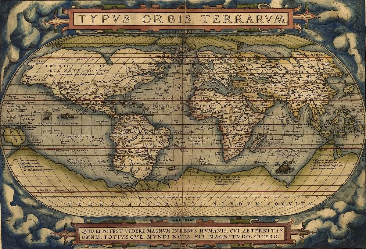
The Vinland Map (shown above) is supposed to be an early map of the world. It was supposedly made in the 15th century, showing Norse expeditions to North America that predated the Columbian expeditions. Since its discovery, scholars have debated its authenticity.
Early Modern Maps
As a rule, early world maps made by Europeans are precious artifacts. When put in chronological order, they help illuminate how different regions of the world were added to Europeans’ worldview. They show developments in shipbuilding and navigation, along with the timeline of exploration and political changes. Most importantly, maps show the world that Europeans thought existed at the time.
The Vinland Map, then, initially achieved recognition because it supposedly belongs to this exclusive club of early modern European maps. We can tell that this map shows an old worldview just by what it includes: the outlines of western Europe look familiar to us today but as we move further away, the coasts of Africa, northern Europe, and Asia become increasingly unrecognizable. Such was the state of knowledge in the early modern period, when Europeans had mapped some, but not all, of the spaces around them. Indeed, the regions further from western Europe were little understood by European cartographers at this time.
What is especially interesting about the Vinland Map is that it includes land in North America. At the very far left, you can see the island of Greenland. If this map were indeed genuine, this would be the first certain depiction of North America in the history of European cartography.
Questions over Authenticity
Almost immediately, however, scholars raised issues with the map that brought into question whether the map was a genuine artifact from early modern Europe or whether it was made in the 20th century.
One of the issues was with the island of Greenland itself. When Europeans first encountered Greenland, they believed that it was a peninsula, attached to a larger landmass in the north. It wasn’t until the 20th century that the island was entirely circumnavigated.
Final Verdict
Recently, it has been decided that the map must be a 20th-century forgery. The final piece of evidence that has recently decided the case definitively is the composition of the ink used to make the map. A study of the ink revealed that it contained anatase, a substance only found in commercial inks starting in the 1920s. Indeed, the ink’s closest match was a kind of ink produced in Norway in 1923. There was no way that the ink could be as old as the map was purported to be.
The parchment—the material on which the map is drawn—does seem to genuinely date from some time in the 1400s. This would mean that while the map itself is fake, the material itself does date from the correct time period. Likely, then, the forger drew the map on a blank page from an authentic early modern book.